Ascanius; or, the Young Adventurer
Bestselling book of the 18th and 19th centuries
home
|
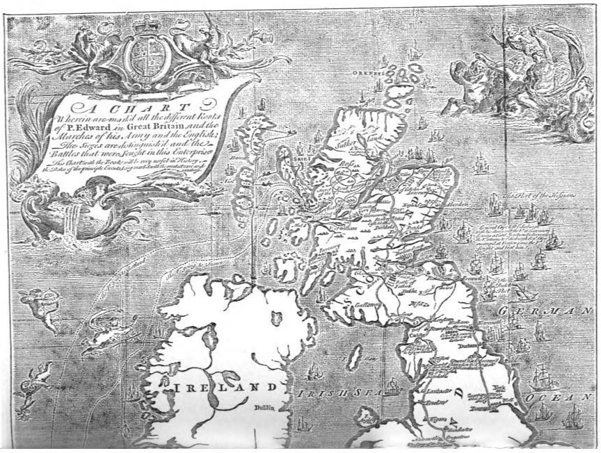
Maps related to the 1745-6 rebellion |
|
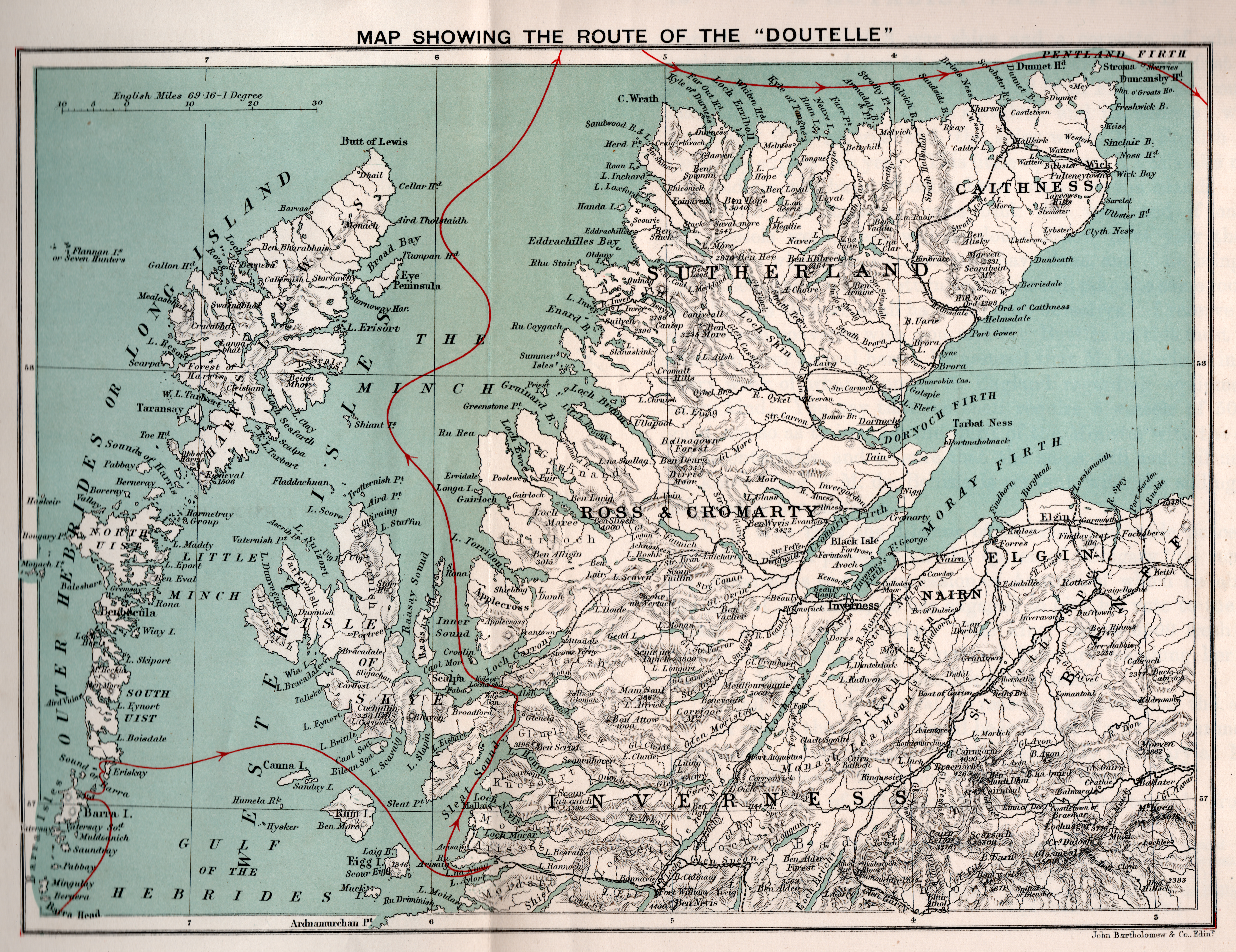
Maps and places from the Itinerary.
This map shows how the clans were distributed in Scotland. From the Gentleman's Magazine volumes XV and XVI of 1745 and 1746.
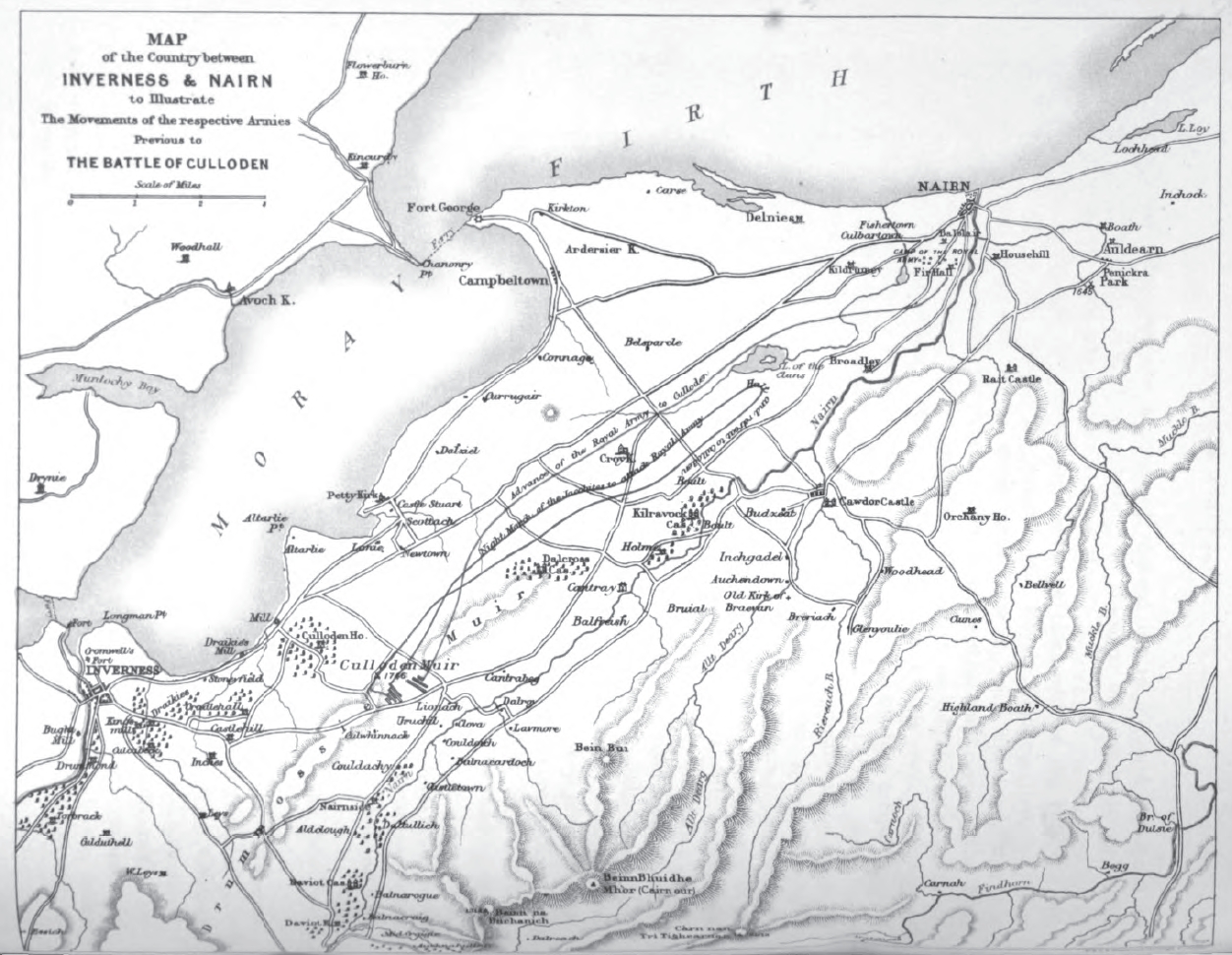
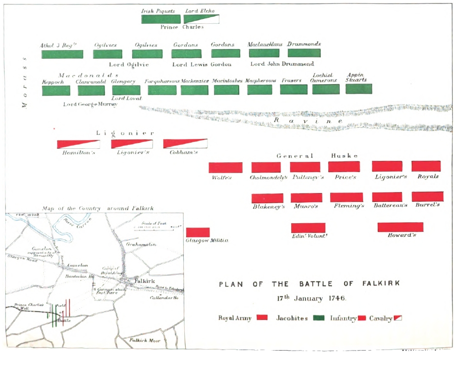
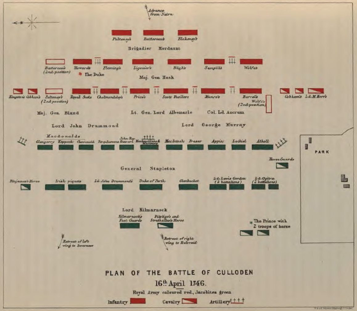
From the Historical geography of the clans of Scotland Inverness and Nairn Falkirk
Culloden The road from Berwick to Carlisle and Carlisle to Lancaster in Ogilby's map of 1675. Maps released by the Bibliothèque nationale de France (BnF) produced by Beaulieu Tréhouart and Marc Joseph Marion-Dufresne, commanders of L'Heureux and Le Prince de Conti when they rescued Prince Charles from Loch nan Uamh in October 1746. Plan de la baye de Loknoüer Plan de la baye de Loknoüer (detail) Plan de la Baye de Withs (Uist) (actually, Loch Boisdale and Calvay Castle) Carte d'une partie de la coste occidentale d'Ecosse Baye de Loknoüer (detail) New Zealand Journal of HistoryNotes Marion du Fresne and the Young Pretender and here transcribed by John Dunmore of Massey University in New Zealand Journal of History, Apr 1969; v.3 n.1:p.70-73; issn:0028-8322. Le nouveau & grand illuminant flambeau de la mer, de tout le monde... by Nicolas Jansz. Vooght, & Gerard van Keulen (Ceulen), Geomêtre, & Maistre en MathematiquesThe complete set of six volumes is available online at the National Library of Spain here. |


")
")

")